A murder of a water body in four years; Satellite imagery bears witness to the horrific crime
By Dheeshma
Hyderabad: It is either die with water or die without water for the people of Hyderabad. Rainwater that was supposed to be a blessing turned into a curse for Navanaami residents. Four satellite imageries reveal how Navanaami residency in Puppuluguda, Hyderabad is flooding due to destruction of inflow channel of a waterbody. The images were released by Dr Lubna Sarwath, Convener of Save Our Urban Lakes (SOUL) in Hyderabad. The satellite imagery points to the slow destruction of the inflow channel and Bholapkur waterbody due to illegal encroachments from 2015 to 2019.
“Even today the residents of Navanaami are pouring out water from their houses. A road obstructs the inflow channel, and the waterbody has been destroyed and thoroughly levelled-off. Whenever there is a recurring downpour, the water has no place to go. Since the water body was destroyed, the outflow channel towards the south of the water body was also somewhat blocked. So, the excess water will enter the basements of Navanaami residence, which is to the north of the waterbody,” said Sarwath.
Over the years, the residents and social activists have been urging authorities to promptly restore the inflow channel and waterbody in survey number 288, by removing all obstructions to rainwater inflows.
The authorities have finally responded to the long battle waged by the Navanaami residents. The Revenue team started inspecting the area under the supervision of Gandipet Revenue Inspector Naveen. Speaking to NewsMeter, Naveen said, “We have inspected the area and understood that the water body had been severely encroached. Also, builders have diverted the channels to drainage systems. Many high-rises are already up, and several constructions are on-going.”
The waterbody demarcated in the HUDA master plan, and Survey of India toposheet has not been identified or named by the Hyderabad Metropolitan Development Authority (HMDA). On the other hand, Google Maps point out that there was a water body, which needs to further go down to Bholakpur channel.
“From our observation, it has been proved that a waterbody existed in this site. A complete report will be handed over to higher authorities. The revenue department will make sure that the lake is revived and encroachers are removed,” Naveen added.
The satellite imagery of 2008 shows Bholakpur inflow channel as well as the waterbody in survey number 288. Coming to the satellite imagery of 2017, we can see the existence of the inflow channel, but the waterbody has started getting filled in survey no. 288. The latest imagery from 2019 reveals how the inflow channel and waterbody have been destroyed.
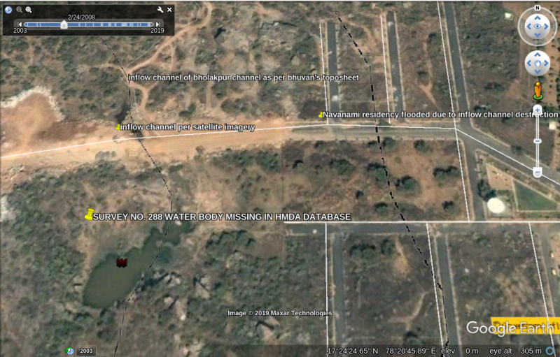 1- Satellite imagery of 2008 that shows inflow channel of Bholakpur channel as well as water body in survey no. 288.
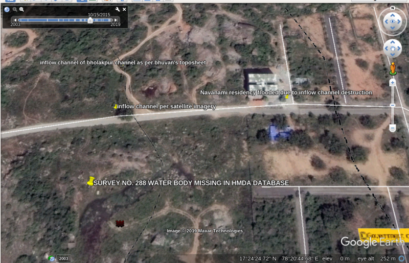 2- Satellite imagery of 2015 that shows existence of inflow channel and water body in survey no. 288.
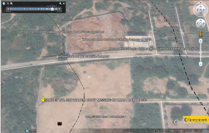 3- Satellite imagery of 2017 that shows existence of inflow channel north of water body and destruction of water body survey no. 288.
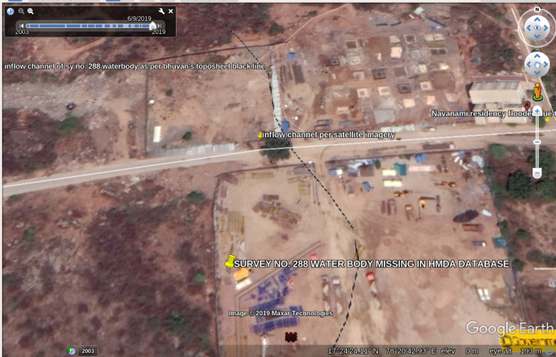 4- Satellite imagery of 2019 that shows destruction of inflow channel and destruction of water body survey no. 288.