SATELLITE JOURNALISM - Page 4
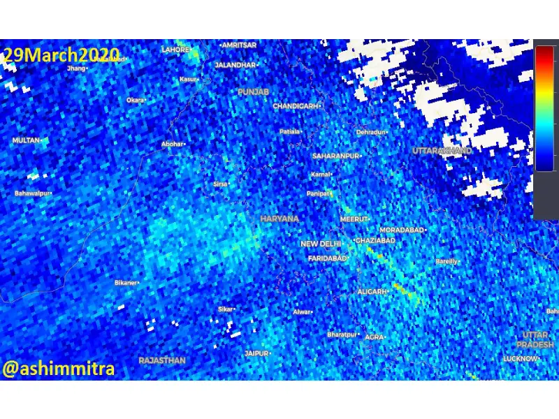
Satellite Images show considerable drop in Delhi’s pollution levels
Hyderabad: Satellite images taken by Sentinel hub India show that Nitrogen Oxide levels have decreased in Delhi and other nearby states given the...
By Aiswarya Sriram Published on 31 March 2020 11:17 AM IST
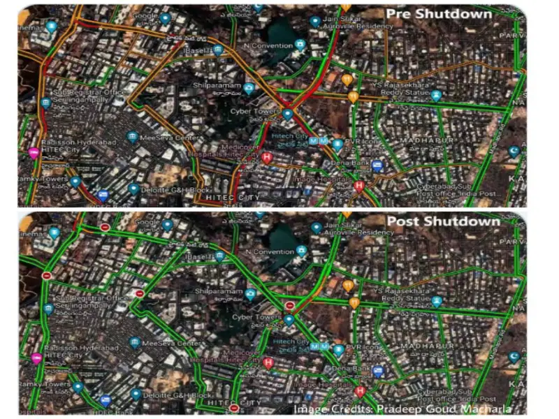
Satellite images show Hyderabad’s IT corridor before and after lockdown
Hyderabad: On the first day of the lockdown, Hyderabad's IT corridor was not its usual bustling self as seen on satellite images captured at 11 a.m on...
By Amritha Mohan Published on 24 March 2020 9:54 AM IST
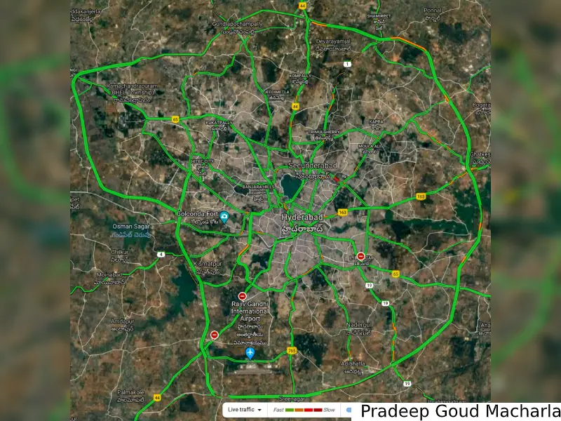
Satellite images show deserted streets, thin traffic in Hyderabad during Janta Curfew
Hyderabad: Satellite images captured around noon on Sunday showed very thin traffic movement on the streets of Hyderabad during Janta Curfew. Streets...
By Dheeshma Puzhakkal Published on 23 March 2020 9:50 AM IST
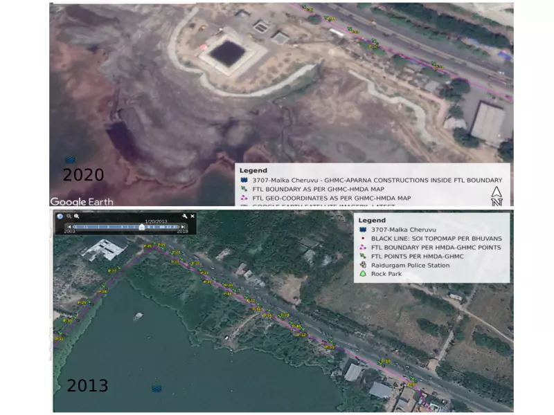
View from the sky: Clash over Malka Cheruvu’s encroachments gets murkier
Hyderabad: Satellite images of Malka Cheruvu in the city's Raidurgam area reveals how the Greater Hyderabad Municipal Corporation (GHMC) has...
By Dheeshma Puzhakkal Published on 15 March 2020 2:37 PM IST
Satellite data expose: NGT to investigate Phoenix Spaces' encroachment of Mamasani Kunta
Hyderabad: Satellite data has revealed Mamasani Kunta water body has allegedly been encroached by Phoenix Spaces Pvt Ltd.According to Google Earth...
By Dheeshma Puzhakkal Published on 11 March 2020 1:14 PM IST
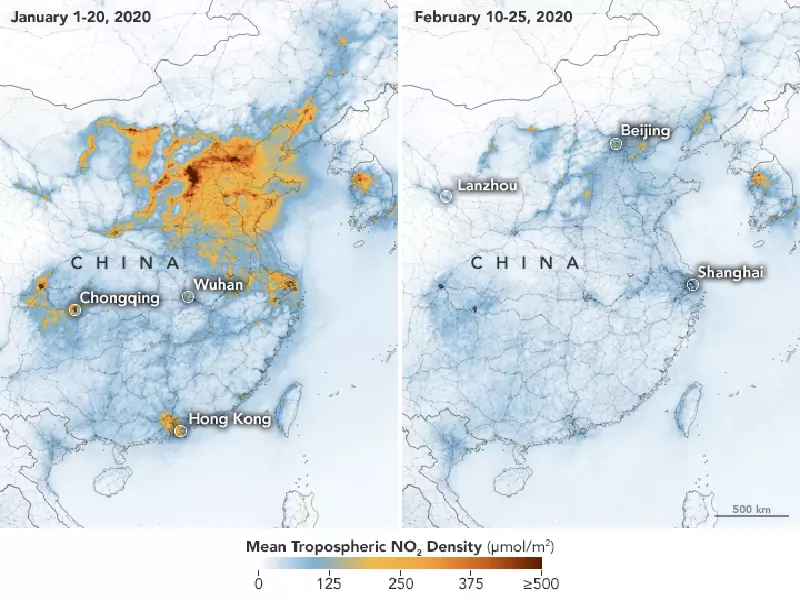
China's pollution levels down due to Coronavirus, says satellite data
Hyderabad: Satellite images released by Nasa and the European Space Agency shows that there has been a significant decrease in the nitrogen dioxide...
By Aiswarya Sriram Published on 1 March 2020 8:09 PM IST
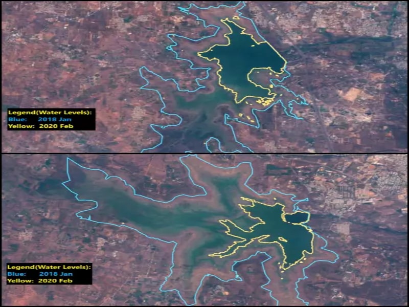
Satellite images of Osmansagar, Himayatsagar show summer will be harder in Hyderabad
Highlights Authorities ridiculed for ‘less rain water’ utterances Mismanagement could add to summer worries ...
By Dheeshma Puzhakkal Published on 25 Feb 2020 5:34 PM IST
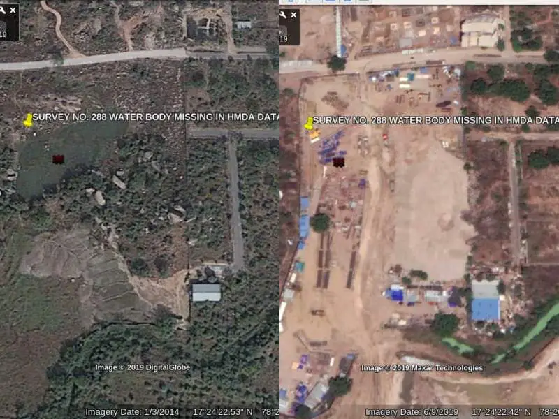
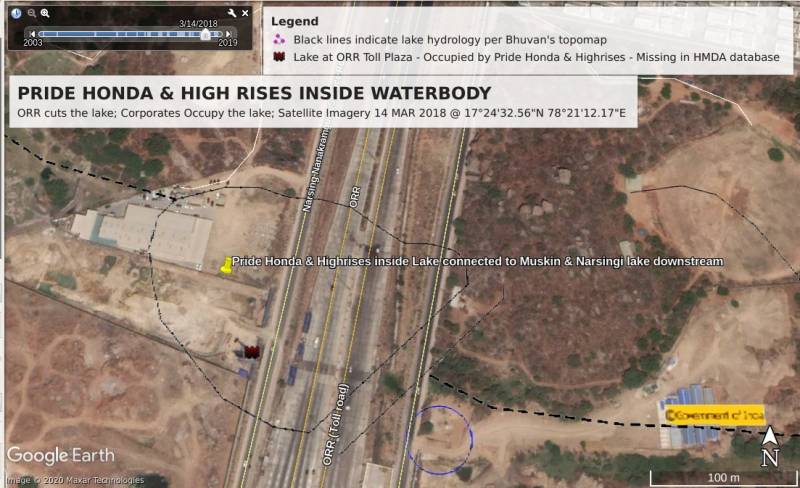
Satellite reveals blatant occupation of Puppulguda water body by Pride Honda, HMDA clueless
Hyderabad, Feb 21: Satellite images reveal the blatant occupation in Puppulguda lake, a water body which is, in fact, missing from the HMDA data...
By Dheeshma Puzhakkal Published on 21 Feb 2020 4:57 PM IST
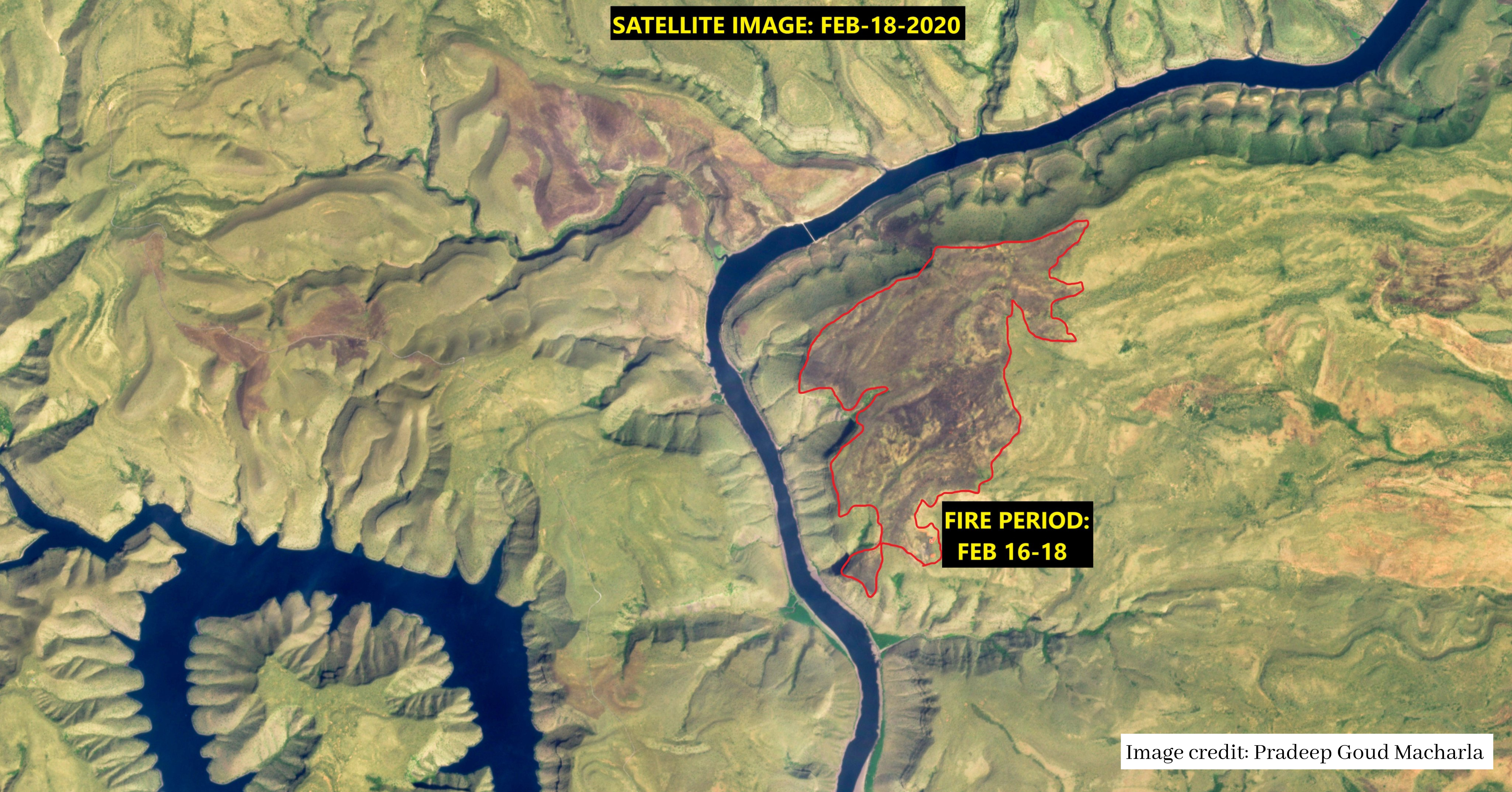
Satellite captures forest fire in Nallamala; officials clueless
Hyderabad: Satellite data indicates that there is a continuous forest fire on the Andhra side of Nallamala. According to the data, almost 1, 500 acres...
By Dheeshma Puzhakkal Published on 19 Feb 2020 4:00 PM IST
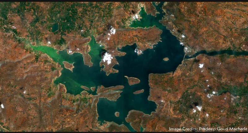
Satellite image of Nagarjuna Sagar reveals algal bloom invading the reservoir
Hyderabad: Satellite images of Nagarjuna Sagar reveals that algal blooms are choking the reservoir. The satellite data captured on 12 February shows...
By Dheeshma Puzhakkal Published on 18 Feb 2020 8:55 AM IST
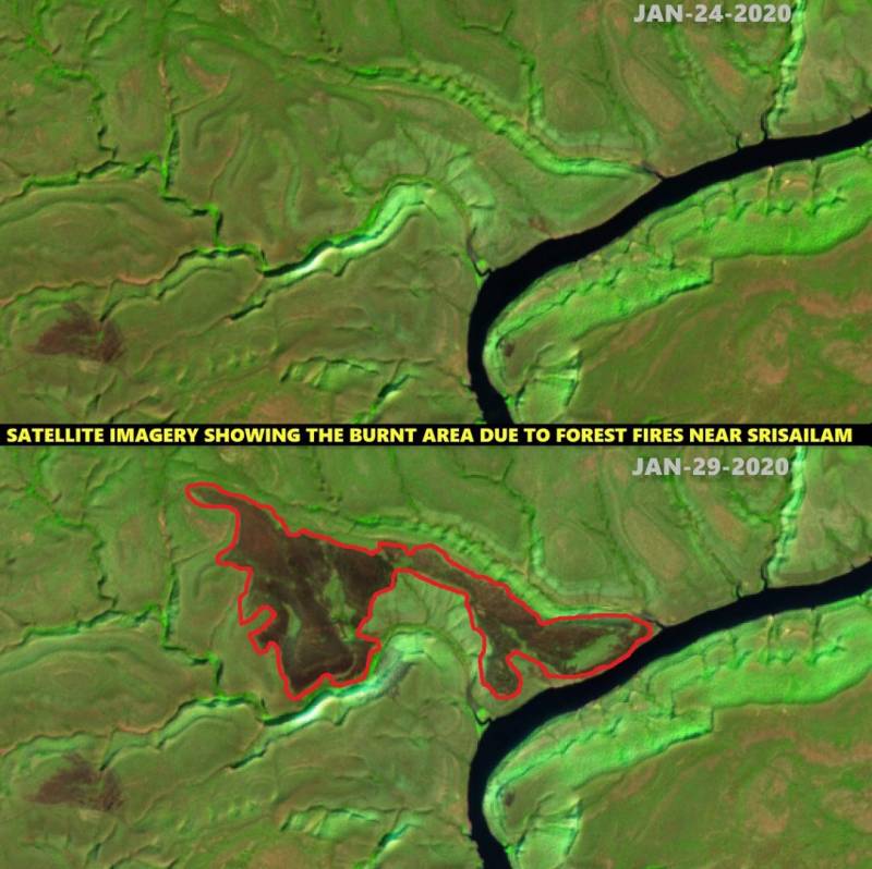
Satellite images reveal Nallamala was on fire even in January
Hyderabad: Satellite images reveal that Nallamala forest was on fire even in January. According to the satellite data, there was a fire incident in...
By Dheeshma Puzhakkal Published on 6 Feb 2020 2:53 PM IST
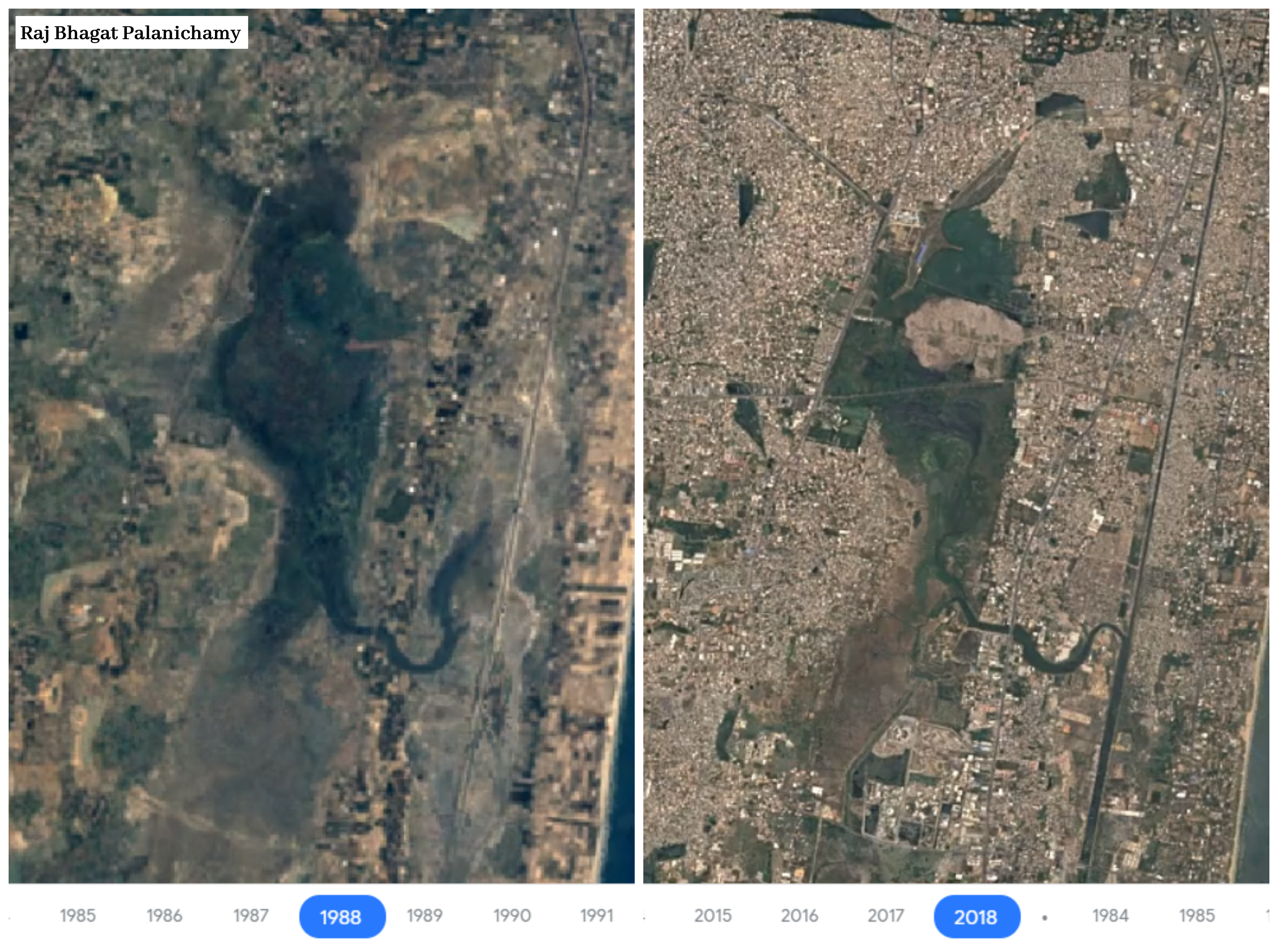
Satellite images reveal Pallikaranai marshland shrinks by 93% in last 30 years
Hyderabad: An environmental disaster is unfolding in Chennai after satellite images revealed that the ecologically rich Pallikaranai wetland has...
By Dheeshma Puzhakkal Published on 5 Feb 2020 12:12 PM IST
