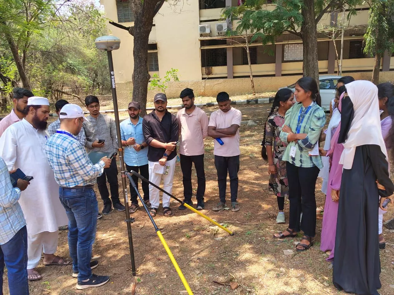
Osmania University spearheads geospatial mapping process in TG, AP
The central focus of the workshop was to elucidate the methodologies for efficient data collection and the diverse applications of the data
By Newsmeter Network
Osmania University spearheads geospatial mapping process in TG, AP
Hyderabad: Osmania University, in a significant stride towards fostering cutting-edge geospatial technology, hosted a highly impactful workshop on the Continuously Operating Reference System (CORS).
The event, organized by the Department of Geography at Osmania University in collaboration with the Telangana & Andhra Pradesh Geospatial Directorate and the Survey of India, Hyderabad, underscored the critical importance of advanced data collection and utilization in modern surveying and mapping practices.
The inaugural function was graced by the esteemed Prof. G. Prabhakar, Principal, University College of Science (UCS), Osmania University, who served as the Chief Guest. His presence highlighted the institution's commitment to promoting practical and technologically relevant education.
The workshop also benefited from the insights of the distinguished Guests of Honor: Prof. P. Naveen Kumar, Chairman, Board of Studies (BoS), Department of Electronics and Communication Engineering (ECE), Osmania University, representing interdisciplinary collaboration, and Mr. Manchala Santosh, Superintendent Surveyor, Survey of India (SOI) & General Secretary, Indian National Cartographic Association (INCA), brings invaluable expertise from national surveying bodies.
The workshop featured leading experts in the field such as Resource Persons: Sri. H. K. Harish, Officer Surveyor (OS), Telangana & Andhra Pradesh Geospatial Directorate, Survey of India, and Mr. A. Ramesh, Officer Surveyor (OS), Telangana & Andhra Pradesh Geospatial Directorate, Survey of India. Their in-depth knowledge and practical experience provided attendees with a comprehensive understanding of the intricacies of collecting and effectively utilizing data through the Continuously Operating Reference System.
Presiding over this pivotal event was Prof. Ashok Kumar Lonavath, Head of the Department (HoD), Department of Geography, Osmania University. His leadership was instrumental in bringing together this crucial workshop. The seamless coordination of the programme was expertly handled by Dr. Mohd. Akhter Ali, Assistant Professor, Department of Geography, Osmania University, ensuring a productive and insightful experience for all participants.
The central focus of the workshop was to elucidate the methodologies for efficient data collection and the diverse applications of the data acquired through the Continuously Operating Reference System. This technology holds immense potential for enhancing accuracy and efficiency in various sectors, including urban planning, infrastructure development, disaster management, and environmental monitoring.
This collaborative initiative between Osmania University, the TG & AP Geospatial Directorate, and the Survey of India underscores the commitment of these organizations to advancing geospatial knowledge and its practical implementation. The workshop served as a vital platform for knowledge sharing and capacity building, equipping participants with the skills necessary to leverage the power of CORS technology for societal benefit.