Fact Check: No, Google Maps has not removed LOC from Indian map
By Satya Priya BN
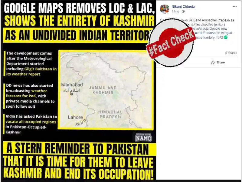
Tension at the LoC between India and Pakistan fails to reduce even when the entire world is in the grip of Covid-19 pandemic. In such a situation, a photo of Indian map taken from Google Maps is going viral in social media with the claim "Jai ho, Google Maps removes LoC and shows Gilgit, entire PoK as part of India. One can check it on Google Maps."
Also, on Facebook, posts are claiming that "Google Maps removed LoC. India is marching to acquire PoK. It is just a matter of time PoK will be ours. Yesterday, the IMD released the weather forecast for Gilgit-Baltistan region.MEA asked PAK to vacate PoK saying it's Indian territory. Something big is coming. Jai Hind."
Not only the LoC, but also the LAC (Line of Actual Control) between India and China seem to be removed from Google Maps.
Fact Check:
This claim is FALSE.
Google changed its policy in February, 2020, where Google Maps has redrawn the world's borders that look different depending upon where the user is viewing them from, with the popular search engine showing Kashmir's outlines as a dotted line acknowledging "dispute" when it is seen from outside India, a leading American daily has reported.
According to a report in Washington Post, in February, Ethan Russel, the director of product management for Google Maps mentioned that "the company's goal is always to provide the most comprehensive and accurate map possible based on ground truth."
https://www.washingtonpost.com/technology/2020/02/14/google-maps-political-borders/
Google Maps are created through a combination of satellite imagery, computer modelling and hand-drawn borders and landmarks, the company has said. It relies primarily on contract workers who specialise in, say, tracking the construction of new types of buildings or roadways, according to the company.
We can check the Google policies on Maps.
https://support.google.com/maps/answer/3145721?hl=en
According to a report published in Outlook India in February, 2020, Google Maps shows Kashmir's outlines as a dotted line acknowledging "dispute" when it is seen from outside India as the search engine redraws the world's borders based on where the user is viewing them from. So, the borders in the Google Maps depend on the area the person is viewing the maps from. In India, the disputed LoC is NOT visible but outside India, the LoC is visible.
Google's official spokesperson says that, "We are committed to providing our users with the richest, most up-to-date and accurate maps possible. We do border updates based on data from our providers as new or more accurate data becomes available from authoritative sources or as geopolitical conditions change just as we did for the state of Telangana in 2014."
IMB, on the other hand, has started including Gilgit-Baltistan and Muzaffarabad, which are parts of PoK, under the Jammu and Kashmir meteorological sub-division since May 5.
Hence, the claim that Google removes LoC recently is FALSE. Google changed its policies in February, 2020, according to which changes were made.
So, the above viral claim is FALSE.