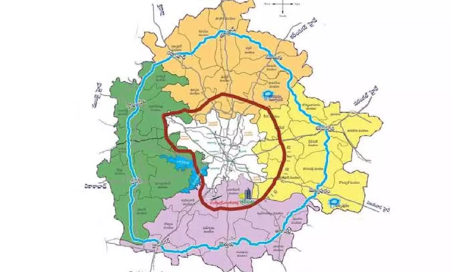
Hyderabad: HMDA issues preliminary notification for 354 km RRR; citizens asked to send feedback
The notification lists lands, along with survey numbers, that will be affected across various mandals and villages in multiple districts.
By Newsmeter Network
Hyderabad: HMDA issued preliminary notification for 354 km RRR; citizens asked to send feedback
Hyderabad: Hyderabad Metropolitan Development Authority (HMDA) has issued a preliminary notification for the proposed Regional Ring Road (RRR), planned with a 100-meter width.
The notification lists lands, along with survey numbers, that will be affected across various mandals and villages in multiple districts.
Citizens can submit objections or suggestions until September 15, 2025, after which the final notification will be released. The document also includes a digital roadmap and Google coordinates for precise mapping.
Extending Hyderabad’s metropolitan boundary
The RRR project is designed to support Hyderabad’s future urban expansion, infrastructure development, and layout planning. HMDA officials noted that the notification provides clarity for land acquisition, layout approvals, and construction permits in affected areas.
HMDA jurisdiction expands
HMDA’s jurisdiction has increased from 7,257 sq km to 10,472.723 sq km, now covering 11 districts: Hyderabad, Ranga Reddy, Medchal, Siddipet, Sangareddy, Medak, Yadadri, Nalgonda, Nagercoil, and Mahbubnagar. This includes 1,355 villages and 104 mandals, reflecting the city’s rapidly expanding metropolitan reach.
Impact on villages and mandals
The proposed 354 km regional ring road will affect numerous villages and mandals across these districts. The notification specifies the revenue villages, mandals, and districts that will be impacted.
Officials also clarified that lands in eight outer districts- Mahbubnagar, Medak, Nalgonda, Ranga Reddy, Sangareddy, Siddipet, Vikarabad, and Yadadri Bhuvanagiri, covering 33 mandals and 163 villages, will not be affected by the project.