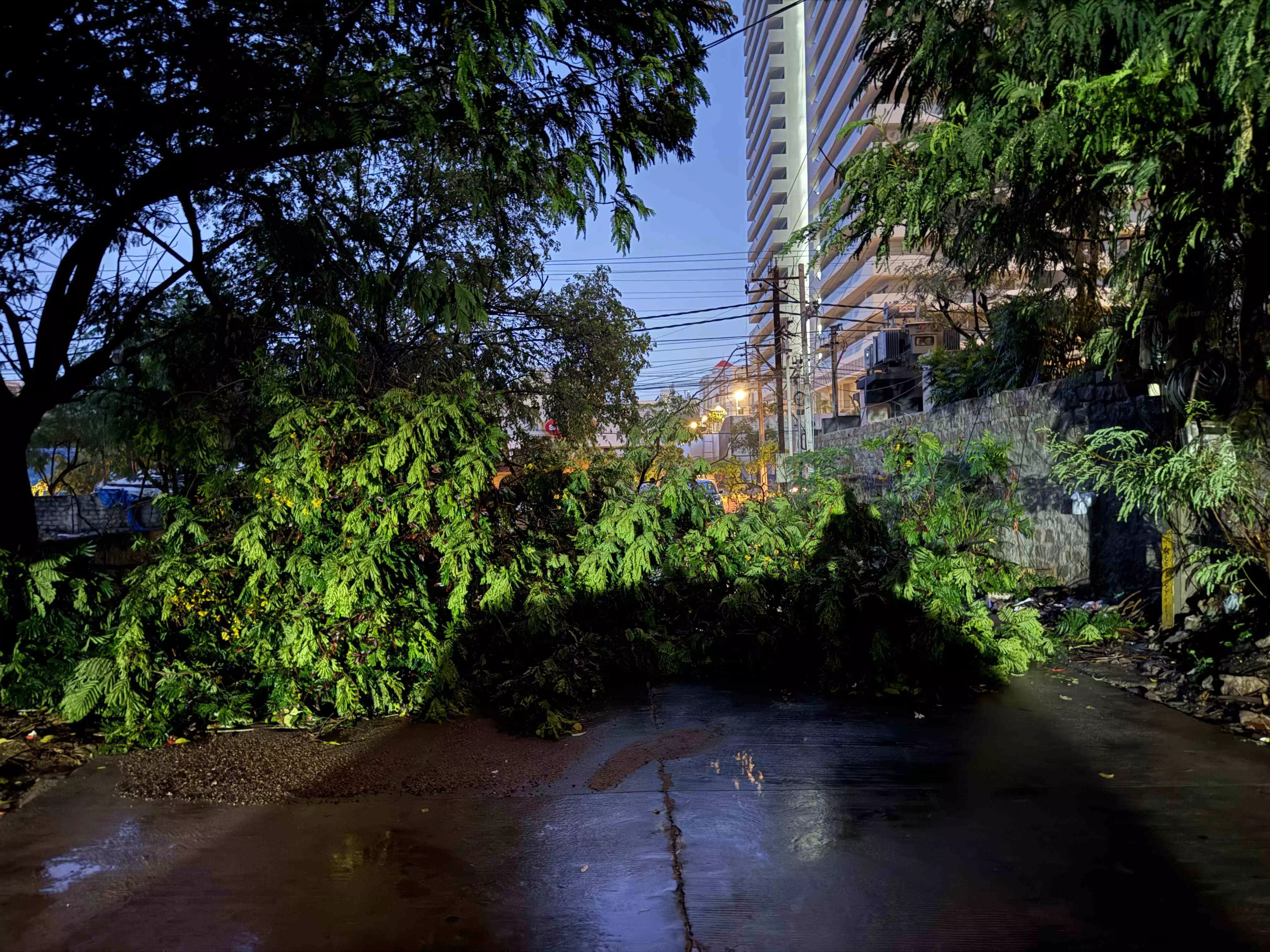
Hyderabad receives heavy rainfall, UoH records highest of 148.5 mm; meteorologists say no cloudburst occurred
The cloudburst-like event began late at night, catching many residents off guard
By - Anoushka Caroline Williams |
Hyderabad: Hyderabad received heavy rainfall on Wednesday night, leading to waterlogging in several areas.
The intense spell, which began late in the night, led to significant waterlogging in the University of Hyderabad, Lingampally, and Chandanagar.
Western Hyderabad Hit Hardest
According to data from the Telangana State Development Planning Society (TSDPS), the University of Hyderabad area received the highest rainfall at 148.5 mm. MMTS Lingampally followed closely with 114 mm, while Chandanagar logged 109.8 mm. Other localities in the western corridor also saw substantial rain, with Gachibowli recording 81.3 mm, Miyapur 46.3 mm, BHEL 26.3 mm, KPHB 23.3 mm, and Rajendranagar 19.3 mm.
Though skies were overcast for most of the day on Wednesday, no rainfall was reported during daylight hours. The cloudburst-like event began late at night, catching many residents off guard.
Was It a Cloudburst?
While the rainfall at UoH and nearby areas was significant and intense, meteorologists have clarified that it does not qualify as a cloudburst.
A cloudburst is defined as a highly localized, short-duration weather event where more than 100 mm of rainfall occurs within an hour, often leading to flash floods, landslides, or severe disruption. These events are more common in hilly or mountainous regions.
In Hyderabad’s case, although 148.5 mm of rain was recorded, it occurred over several hours, not within a single hour. Additionally, the event lacked the extreme flash flooding or topographical features typically associated with a cloudburst.
Meteorologists Explain Sudden Downpour
Experts say the downpour was caused by intense localized convection—a common phenomenon during early monsoon phases. “What we saw in parts of Hyderabad was a result of high moisture content in the lower atmosphere, combined with rapid vertical air movement due to daytime heating,” said K. S. Sridhar, a meteorologist with the India Meteorological Department (IMD), speaking to Newsmeter.
“These are not uncommon in pre-monsoon and monsoon onset periods, particularly when there’s a moisture surge from the Bay of Bengal. The clouds develop quickly and dump large volumes of rain in short spans, especially over inland urban zones where heat build-up is higher,” he added.
Urban Impact and Response
While there were no reports of major flooding, residents in affected areas reported waterlogging on key roads and low-lying colonies. GHMC’s Disaster Response Force (DRF) teams were deployed to clear clogged drains and monitor areas at risk.
Forecast and Outlook
IMD officials said Hyderabad can expect more isolated spells of moderate to heavy rainfall over the next few days. “The monsoon has become active again over Telangana, and conditions are now favorable for regular rainfall patterns to establish,” said Sridhar.
Authorities have urged citizens to stay updated with official forecasts and avoid venturing out during intense rainfall periods.
For updates and rain alerts, residents can check the TSDPS portal or follow IMD Hyderabad’s official bulletins.