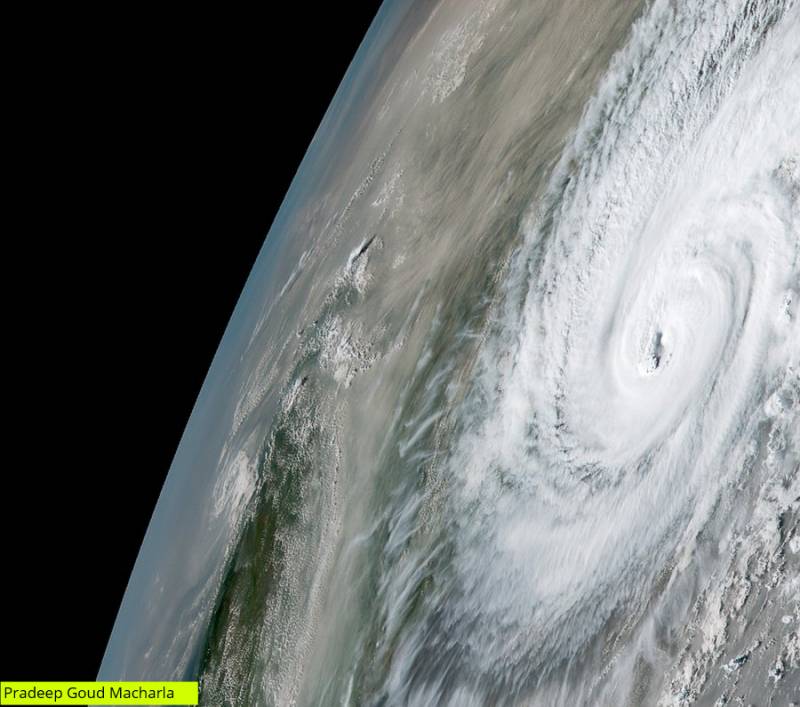
Satellite images show Cyclone Bulbul's preparation of landfall along Indo-Bangla border
By Dheeshma Puzhakkal
Kolkata: Satellite images show how cyclone Bulbul prepared to make a landfall between Sagar Islands of West Bengal and Khepupara in Bangladesh, late Saturday night. The very severe cyclone made a landfall over Indo-Bangladesh coast around 8:30pm Saturday. Later, Bulbul crossed the devastated West Bengal and moved towards Bangladesh.
Cyclone Bulbul heads towards Bengal
According to the latest reports from the Meteorological department, Cyclone Bubul, which formed over East Central Bay of Bengal, has crossed coastal Bangladesh and its neighbourhood. The Cyclone moved from the coast of West Bengal east-northeastwards at a speed of 14kmph in the last six hours.
�
Deep depression likely
According to weather experts from Skymet Weather, during the next six hours, the Cyclone is very likely to move east-north-eastwards and weaken into a deep depression over coastal Bangladesh and its neighbourhood and into a Depression during the subsequent six hours.
Cyclone Bulbul kills two in Kolkata
As of now, two casualties have been reported in Kolkata due to the storm. Also, around 100,000 people have been evacuated from low-lying coastal villages and islands in Bangladesh.
According to experts as the cyclone has weakened, the threat for West Bengal is over. Bulbul will develop into a deep depression soon and move towards Northeast India.
�
Hurtling high-speed cyclonic storm ‘Bulbul’ is set to make landfall by 11 pm Saturday night between Sagar Islands of West Bengal and Khepupara in Bangladesh and move northwestwards into the neighbouring country over the Sunderban delta.(src:https://t.co/z3G7vmxOgd)
? Pradeep Goud Macharla 🌍 (@Macharlazz) November 9, 2019
🛰️Himawari-8 https://t.co/Ue3oG4JMGW pic.twitter.com/tUa17EiwD4