SATELLITE JOURNALISM - Page 6
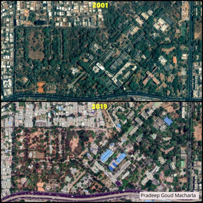
Satellite images raise concern for green cover in Hyderabad's KPHB and Tarnaka
Hyderabad: A satellite image comparison of Kukatpally Housing Board Colony region, Hyderabad shows unprecedented urbanisation in the area. KPHB, also...
By Dheeshma Puzhakkal Published on 13 Dec 2019 2:00 AM IST
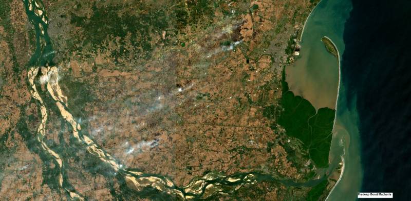
Farm fire caught on Satellite: It's happening here at Godavari delta in AP
Highlights Expert blames stubble burning Calls for better use of grassHyderabad: Satellite data acquired by Sentinel-2 reveals that Andhra Pradesh and...
By Dheeshma Puzhakkal Published on 10 Dec 2019 3:19 PM IST
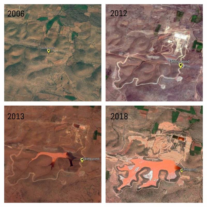
A view from the satellite: Kadapa turns into a uranium cemetery
Hyderabad: India’s biggest uranium mine is to come up in Kadapa district of Andhra Pradesh. With 6,000 tonnes of uranium produced per day, this mine...
By Dheeshma Puzhakkal Published on 25 Nov 2019 4:16 PM IST
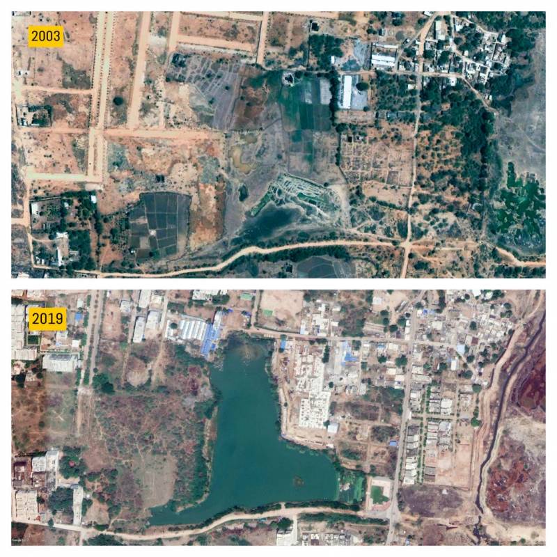
A view from the satellite: The revival of Ibrahimbagh lake at the cost of River Musi
Hyderabad: The last of the lakes built by Ibrahim Qutb Shah, Ibrahimbagh lake was once home to many aquatic lives and was an abode of crystal-clear...
By Dheeshma Puzhakkal Published on 15 Nov 2019 11:02 PM IST
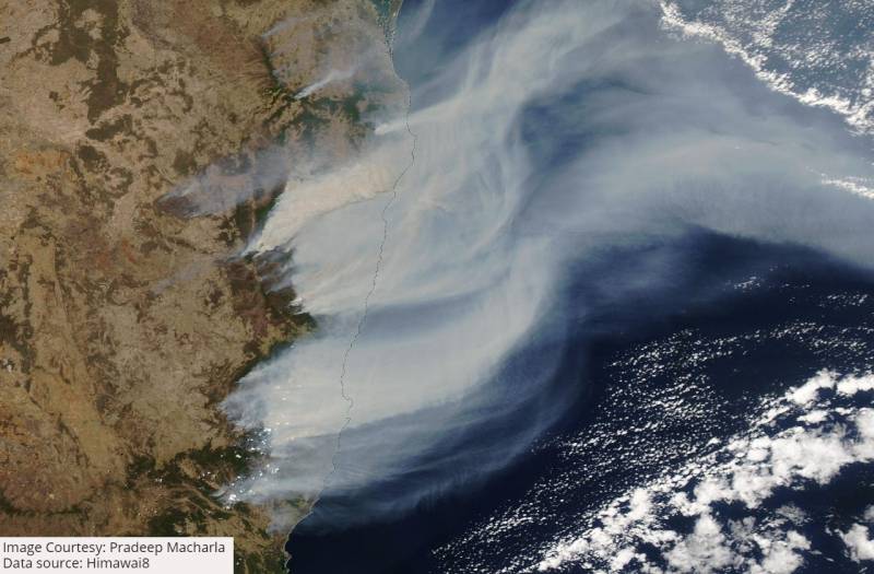
Satellite images show how bushfire in Australia turned New Zealand's sky red
New South Wales: Australia’s New South Wales (NSW) and Queensland are burning due to wildfires. Satellite images captured by SNPP-VIIRS show how smoke...
By Dheeshma Puzhakkal Published on 10 Nov 2019 7:49 PM IST
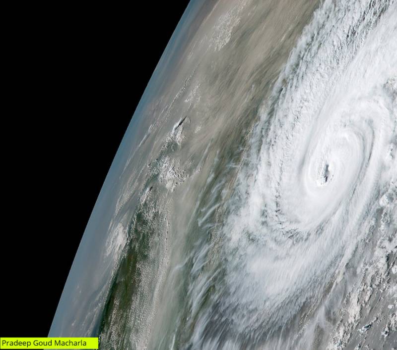
Satellite images show Cyclone Bulbul's preparation of landfall along Indo-Bangla border
Kolkata: Satellite images show how cyclone Bulbul prepared to make a landfall between Sagar Islands of West Bengal and Khepupara in Bangladesh, late...
By Dheeshma Puzhakkal Published on 10 Nov 2019 4:45 PM IST
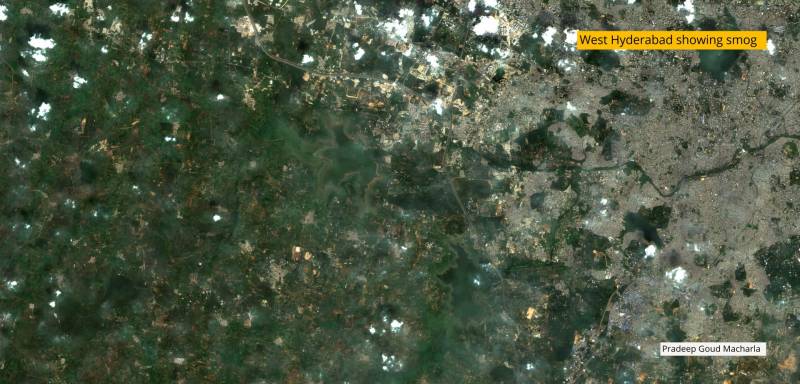
Delhi smog in Hyderabad? City's AQI drops
Hyderabad: Latest satellite images released by the Himawari satellite show that stubble burning in Central India contributed to the smog on...
By Newsmeter Network Published on 6 Nov 2019 12:52 PM IST
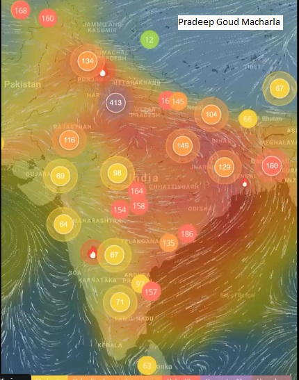
Satellite images suggest that Delhi air pollution might spread to other parts of India
Hyderabad: Days after the worst Air Quality Index for Delhi became a national phenomenon, satellite images suggest that most of India are likely to be...
By Dheeshma Puzhakkal Published on 4 Nov 2019 9:45 PM IST
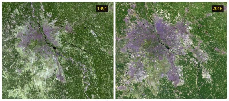
Satellite images show how rising urbanisation led to Delhi's air pollution
New Delhi: In the midst of Delhi’s air pollution emergency, experts suggest that stubble burning may not be the only reason for the prolonged crisis....
By Amritha Mohan Published on 2 Nov 2019 9:18 PM IST
Public Health Emergency declared in Delhi: satellite images tell how bad the pollution is
New Delhi: With the Environment Pollution (Prevention and Control) Authority (EPCA) declaring a public health emergency in Delhi NCR amidst the...
By Anurag Mallick Published on 1 Nov 2019 1:26 PM IST
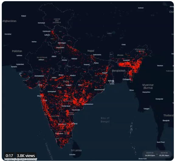
AP & TS lead in forest fires in South India, says Satellite data
Hyderabad: Satellite-based data extracted from VIIRS show there were around half-million fire incidents in the country in 2019. India’s southern...
By Dheeshma Puzhakkal Published on 30 Oct 2019 8:17 PM IST
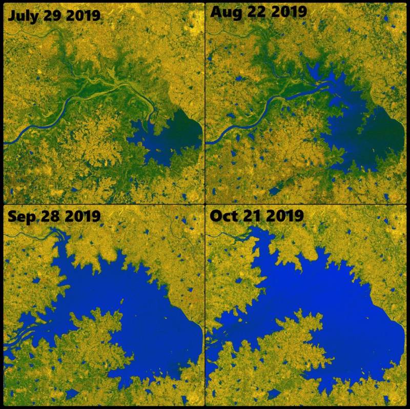
Satellite images indicate good news for farmers from Sriram Sagar
Hyderabad: Satellite images of Nizamabad’s Sriram Sagar Project (SRSP) dated July 29 to October 21 2019, show that the reservoir has been receiving...
By Dheeshma Puzhakkal Published on 25 Oct 2019 10:21 PM IST
