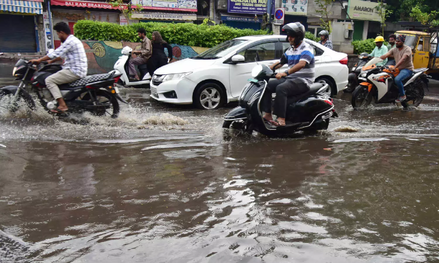
Short-duration rains bring Hyderabad to its knees again; waterlogging, power cuts galore
The India Meteorological Department (IMD) has maintained a yellow alert for Telangana, cautioning that isolated heavy spells, lightning and gusty winds could continue for the next 48–72 hours.
By - Newsmeter Network |
Hyderabad: Short-duration rains caused widespread waterlogging, localised flooding, and traffic and power disruption in Hyderabad on Sunday.
Municipal and disaster-response teams worked through the night to pump water, divert traffic, and search drains after reports that people had been swept away.
The India Meteorological Department (IMD) has maintained a yellow alert for Telangana, cautioning that isolated heavy spells, lightning and gusty winds could continue for the next 48–72 hours.
Where the rain fell
Automatic weather stations and civic reports confirm that some neighbourhoods saw extreme rainfall in just a few hours:
• Musheerabad (Boudha Nagar, Defence Colony): around 120–125 mm
• Secunderabad and central wards (Mettuguda, Tarnaka, Habsiguda, Moula Ali, Kapra): above 100 mm
• Peripheral mandals in Rangareddy and Siddipet also logged heavy totals
The Telangana Development Planning Society recorded similar sharp spikes at multiple stations across the city and state. These concentrated bursts explain why a few wards flooded severely even though overall monsoon totals remain within seasonal norms.
Human impact and emergency response
• Flooding and transport: Underpasses and arterial roads went underwater, leading to diversions. Public transport was slowed, with buses diverted from key choke points.
• Rescues and searches: At least two people were feared washed away in nalas, prompting searches by GHMC, police, and SDRF teams.
• Power and shops: Transformer trips cut supply in several colonies. Ground-floor homes and shops reported damage to goods and parked vehicles.
• Community action: In some wards, residents cleared choked lanes themselves when civic crews could not immediately reach.
Infrastructure failures: roads, drains, and potholes
The rains again exposed the city’s fragile drainage and road system.
Waterlogging and clogged drains
Debris-choked nalas slowed runoff, and colonies in Malakpet, Khairatab, and Falaknuma reported backflow into homes. Pumps were deployed overnight, but several stretches remained unusable through the morning.
Potholes re-emerge
Despite a round of pre-monsoon patching, potholes have quickly resurfaced. Stretches in Musheerabad, Tarnaka, and Uppal that were recently filled now show fresh craters.
“Every time the GHMC fills potholes, the patchwork vanishes with the first heavy rain. We’re back to zigzagging the next week,” said R. Anitha, a commuter from Habsiguda.
A GHMC roads engineer acknowledged the limitation: “These are temporary patches meant to keep traffic moving. Permanent resurfacing is scheduled, but funding and time constraints mean we can’t cover all stretches before the rains.”
Meteorologists say rainfall intensity adds to the problem. “Convective downpours dump water so quickly that road surfaces don’t drain,” explained meteorologist K. S. Sridhar, speaking to NewsMeter. “That standing water accelerates asphalt breakdown.”
Why it happened: technical note
The IMD attributed the storm to convective activity in a moisture-laden monsoon trough. In its operational bulletin, the Met Centre said “heavy rainfall [is] very likely to occur at isolated places” with associated lightning and gusty winds of 30–40 kmph.
Convective storms develop rapidly and drop large volumes of rain in a short span. Combined with urban heat islands, paved surfaces, and blocked drains, this leads to sudden flash floods in low-lying pockets.
What comes next: forecasts and alerts
• 22–23 September: Yellow alert remains in force; intermittent moderate rains expected with isolated intense spells.
• Later this week: A developing low-pressure area in the Bay of Bengal is being tracked. If it strengthens, both coastal Andhra and interior Telangana could see heavier rainfall from 24–25 September.
“People should not expect a continuous downpour,” said Sridhar. “Instead, be prepared for short, sharp spells that can flood a neighbourhood very quickly.”
Immediate guidance for residents
• Avoid underpasses and flooded roads; follow traffic diversions.
• Do not attempt to cross nalas or fast-moving water. Six inches can knock a person down; two feet can float a car.
• Keep documents, medicines, and valuables above ground level in flood-prone homes.
• Report exposed wires or large drain blockages to GHMC helplines.
• Follow official IMD and district bulletins for verified updates.
Civic response and next steps
• Short term: GHMC and SDRF teams will continue clearance, pumping, and search operations. Traffic diversions remain in place at chronic choke points.
• Medium term: If the Bay system deepens, district administrations may pre-position relief units and review evacuation plans for flood-prone mandals. Permanent road resurfacing, promised before the monsoon, is likely to be revisited once conditions permit.