Telangana receives 38% excess rainfall this monsoon
By - Newsmeter Network |
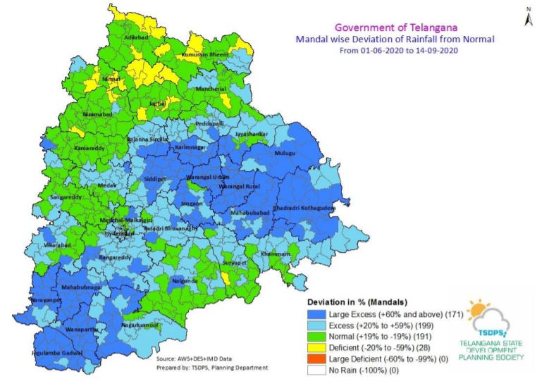
Hyderabad: Telangana has received 38 per cent excess rainfall than expected this monsoon, according to the Telangana State Planning and Development Society. From June 1 to September 14, 2020, the state has received cumulative rainfall of 90.5 mm against the normal 657.5 mm.
The state has received normal to excess rainfall in many mandals and districts. Mulugu, Yadadri Bhuvanagiri, Karimnagar, Mahabubnagar, Mahabubabad, Warangal Urban, Waranga Rural, Suryapet, and Nalgonda districts received large excessive rainfall.
As many as 199 mandals too received excess rainfall of 20-59 per cent while 171 mandals received more than 60 per cent rainfall.

Around 191 mandals in the state received normal rainfall and only 28 mandals registered deficit rainfall till September 14.
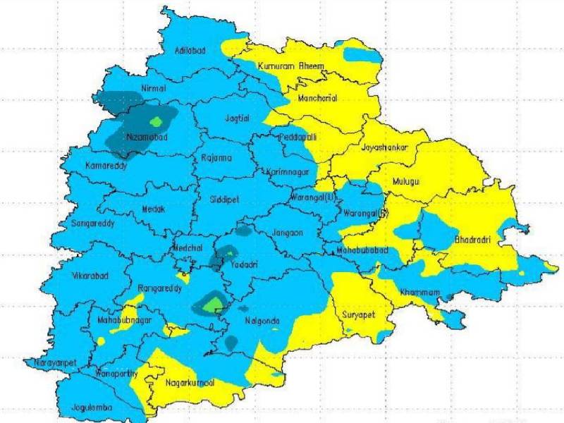
On Monday, Mulugu and Yadadri Bhuvanagiri districts received a very heavy rainfall, more than 115.5 mm, while Mancherial, Jagtial, Jayashankar, Siddipet, Warangal Urban, Suryapet, Khammam and Nalgonda districts received heavy rainfall, more than 64.5 mm.
Vikarabad, Rangareddy, Mahabubnagar and Narayanpet districts received less than 15.6 mm of rainfall. Apart from these 13 districts, all the other districts received a moderate rainfall of 15.6-64.4mm of rain.
In the last 24 hours, a highest rainfall of 145.1 mm was recorded at Valigonda Mandal in Yadadri Bhuvanagiri, while Kukatpally received 27 mm of rainfall, the highest in Hyderabad city.
The Indian Meteorological Department (IMD) has forecasted heavy to very heavy rains at isolated places in different districts of Telangana for the next 72 hours.
The IMD officials said Adilabad, Kumarambheem, Mancheral, Peddapalli, Karimnagar, Siddipeta, Jayashanka Bhupalapally, Mulugu, Bhadradri Kothagudem, Warangal Urban and Rural, Mahabubabad, Jangaon, Yadadri Bhuvanagiri, Khammam, Suryapet, Nalgonda, Ranga Reddy, Medchal, Malkajgiri, Hyderabad and Nagarkurnool districts will receive heavy rain in the next 24 hours.
“The well-marked low-pressure area now lies over west central Bay of Bengal & adjoining north Andhra Pradesh coast with associated cyclonic circulation extending up to mid-tropospheric level (5.8 km above mean sea-level). It is expected to move west northwestwards during the next 3 days,” they said.