Andhra Pradesh to experience a wet March; 'rare' rains in last 10 years
The influence of trough and western disturbance are causing this pattern
By - Sri Lakshmi Muttevi |
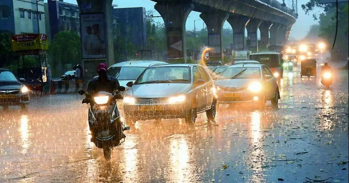
Representational Image.
Amaravati: This March, Andhra Pradesh will see the rarest rains in the last 10 years. It will start on 16 March and get intense on 17, 18, and 19 March. Weathermen are calling it the rarest because March is a dry month as per climatology, and heavy downpour indicates a rare phenomenon.
On Thursday, the Meteorological Centre, Amaravati, in a statement, said that the trough from north interior Tamil Nadu to Konkan now runs from south Tamil Nadu to north Konkan across coastal and interior Karnataka and Goa at 0.9 km above mean sea level. A cyclonic circulation from Bangladesh and neighbourhood to north coastal Andhra Pradesh across Gangetic West Bengal and Odisha lies at 0.9 km above mean sea level, it said.
A fresh Western Disturbance is likely to affect Northwest India from March 19. Under the influence of trough and western disturbance, there will be thunderstorms accompanied by lightning and gusty winds (40–50 kmph) likely at isolated places in NCAP and Yanam and south coastal AP for the next five days.
According to weather forecasters, until Thursday night, scattered thunderstorms and rains are expected in districts like East and West Godavari, Krishna, Eluru, Guntur, Konaseema, and the hilly areas of Vizianagaram, Parvathipuram Manyam, Srikakulam, ASR, and some parts of Prakasam and Nandyal districts. Late on Thursday, there will be an increase in rainfall and thunderstorms.
"The interaction of both trough and western disturbance is causing more shear, making it favourable for powerful thunderstorms, and hail", Praneeth, popularly known as Andhra Pradesh Weatherman told to NewsMeter.
Districts such as Tirupati, Srikakulam, Kadapa, Kurnool, Nandyala, and East Chittoor will see moderate rains with thunderstorms from 17–19 March.
According to Andhra Pradesh weatherman, “As expected, massive thunderstorms are building in the border areas of AP - Telanganamainly Palnadu, NTR (not near Vijayawada), ASR, Parvathipuram Manyam and some parts of Nandyal, Kurnool and Annamayya districts.
As expected, Massive Thunderstorms are building in Border areas of AP - Telangana mainly Palnadu, NTR (not near Vijayawada), ASR, #Parvathipuram Manyam and some parts of #Nandyal, #Kurnool and #Annamayya districts.
— Andhra Pradesh Weatherman (@APWeatherman96) March 16, 2023
More powerful action ahead as we proceed towards Night. pic.twitter.com/6UAY6JLjqT
Fingers crossed for cricket match in Vizag
Visakhapatnam is gearing up for the second One-Day International (ODI) between India and Australia on 19 March at Dr. YSR ACA-VDCA International Cricket Stadium. The change in weather conditions has got the fans tensed.
According to Vizag Weatherman, “On 19 March, there are high chances of thundershowers in or around Visakhapatnam. Rain is more likely to happen during evening hours or night. During summer, we mostly see short bursts (duration less rains) with a quick movement of dark clouds. Whatever, we are going to see a good cricket or, if it rains, a DLS method. A complete washout not expected as per latest scenario.”
Getting many DMs about #Vizag City weather conditions on Match day #INDvAUS . Clarity from my side , On March 19 there are high chances of Thundershowers in or around Visakhapatnam . Rain more likely to happen during evening hours or night. During summer we mostly see short… https://t.co/kUaXJQiPgP pic.twitter.com/UXgEpg7BAe
— Vizag Weatherman (@VizagWeather247) March 13, 2023
IMD weather warning for next five days
March 16: Thunderstorm accompanied by lightning and gusty winds (40–50 kmph) likely at isolated places in NCAP and Yanam and south coastal AP.
March 17: Thunderstorm accompanied by lightning and gusty winds (40–50 kmph) likely at isolated places in NCAP, Yanam, and SCAP.
March 18: Heavy rain is likely at isolated places in NCAP, Yanam, and SCAP. Thunderstorms accompanied by lightning and gusty winds (30–40 km) are likely at isolated places in NCAP and Yanam, SCAP and Rayalaseema.
March 19: Thunderstorm accompanied by lightning and gusty winds (30–40 kmph) likely to occur at isolated places in NCAP and Yanam, SCAP and Rayalaseema.
March 20: Thunderstorm accompanied by lightning and gusty winds (with a speed of 30–40 kmph) likely at isolated places in NCAP and Yanam, SCAP and Rayalaseema.