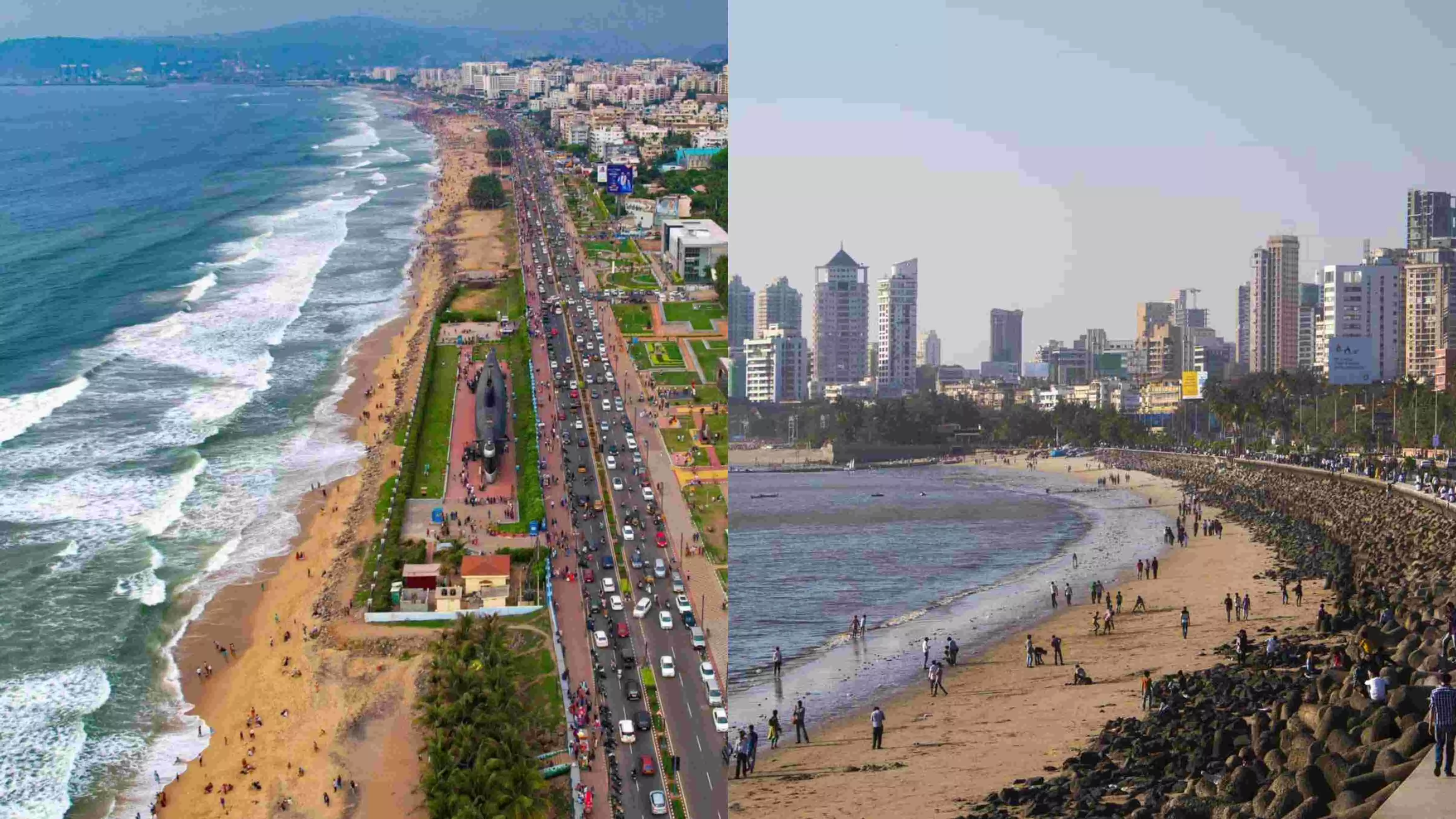
Rising sea levels could submerge 1% of land in Visakhapatnam, 10% in Mumbai by 2040: CSTEP study
Visakhapatnam Port, VUDA Tenneti Park, Rushikonda, and Mangamaripeta Beach areas at possible risk
By Sri Lakshmi Muttevi
Rising sea levels could submerge 1% of land in Visakhapatnam, 10% in Mumbai by 2040
Visakhapatnam: A new study has revealed that the rising sea levels could submerge up to one percent of land in Visakhapatnam, and more than 10 percent of the land in Mumbai by 2040.
A study conducted by the Bengaluru-based Center for Study of Science, Technology, and Policy (CSTEP) said rising sea levels could submerge more than 10 percent of the land in Mumbai, Yanam, and Thoothukudi; 1-5 percent of land in Kochi, Mangalore, Visakhapatnam, Udupi, and Puri.
Rising sea levels are a major hazard to coastal cities worldwide, including Indian coastal cities. Key sectors that will be impacted include water, agriculture, forest and biodiversity, and health. The beaches, backwaters, and mangrove forests are particularly at risk, impacting biodiversity and tourism.
7 sq km area in Vizag:
Visakhapatnam is known for its best beach and attracts both domestic and international tourists. As per the study, around 7 sq km of the city’s area could be inundated. Locations close to the coast especially the Visakhapatnam Port, VUDA Tenneti Park, Rushikonda, and Mangamaripeta Beach are at possible risk.
Highest inundation would occur in Visakhapatnam 1.09% (7.43 sq. km) by 2040, 1.93% (13.14 sq. km) by 2060, 4.89% (33.35 sq. km) by 2080, and 9.03% (61.58 sq. km) by 2100; followed sq. km) by 2060, 4.89% (33.35 sq. km) by 2080, and 9.03% (61.58 sq. km) by 2100.
More than 10 percent of the land in Mumbai and up to 10 percent in Panaji and Chennai is at risk of inundation by 2040 due to climate change-induced sea-level rise.
Titled `Sea level rise scenarios and inundation maps for selected Indian coastal cities', the report examined sea-level change under historical and future climate scenarios in 15 Indian coastal cities and towns -- Chennai, Mumbai, Thiruvananthapuram, Kochi, Mangalore, Visakhapatnam, Kozhikode, and Haldia, Kanyakumari, Panaji, Puri, Udupi, Paradip, Thoothukudi and Yanam.
10% of land in Mumbai:
Mumbai has experienced the maximum rise in sea levels (4.440 cm), followed by Haldia (2.726 cm), Visakhapatnam (2.381 cm), Kochi (2.213 cm), Paradip (0.717 cm), and Chennai (0.679 cm) from 1987 to 2021, the study revealed.
By 2100, the inundation would be higher in Tier-II cities (Mangaluru and Haldia) and towns (Paradip, Thoothukudi, and Yanam) than in Tier-I cities (Chennai and Mumbai) under the high emission scenario.
By 2100, sea levels would rise by 76.2 cm in Mumbai, 75.5 cm in Panaji, 75.3 cm in Udupi, 75.2 cm in Mangalore, 75.1 cm in Kozhikode, 74.9 cm in Kochi, 74.7 cm in Thiruvananthapuram, and 74.7 cm in Kanyakumari even under the medium-emission scenario.
In Mumbai, sea level rise is projected to be 18.6 cm, 35 cm, 54.6 cm, and 76.2 cm by 2040, 2060, 2080, and 2100, respectively.
"Further, the rise in sea levels will continue until the end of the century under all IPCC shared socioeconomic pathway scenarios in all 15 cities and towns, with the highest rise predicted for Mumbai," the report said.
Shared socioeconomic pathways are climate change scenarios of projected socioeconomic global changes up to 2100.
CSTEP said that more than 10 percent of the land in Mumbai, Yanam, and Thoothukudi; 5-10 percent in Panaji and Chennai; and 1-5 percent in Kochi, Mangaluru, Visakhapatnam, Haldia, Udupi, Paradip, and Puri would be submerged due to rise in sea levels by 2040.
Land submergence would be higher in 2100 in Mangalore, Haldia, Paradip, Thoothukudi, and Yanam than in Mumbai and Chennai under the high-emission scenario. Haldia, Udupi, Panaji, and Yanam -- having significant agricultural areas, wetlands, and waterbodies -- will face inundation due to rising sea levels.
Sea level rise- a major concern:
Sea level rise (SLR) has been recognized as the most serious global threat. Continuing greenhouse gas (GHG) emissions are increasing global temperatures, causing thermal expansion of ocean water, and accelerating the melting of mountain glaciers and ice sheets, eventually raising sea levels.
The Intergovernmental Panel on Climate Change (IPCC) has projected a global mean SLR of 1.3 to 1.6 m by 2100 under the high-emission scenario. Rising sea levels are a major hazard to coastal cities worldwide, including Indian coastal cities.
Why Map SLR for Coastal Cities?
Sea level rise, combined with rapid urbanization, has considerably increased risks to the coastal cities. By 2050, over 800 million people (10% of the world and 13% of the total urban population), living in more than 570 coastal cities, will be at risk of at least 0.5 m of SLR and coastal flooding (UCCRN technical report, 2018).
India, surrounded by the Indian Ocean, Arabian Sea, and Bay of Bengal, has a 7,517-km coastline, making SLR a crucial concern to the country. About 170 million people or 15.5% of the nation’s population are spread across nine coastal states and union territories (Gujarat, Maharashtra, Goa, Karnataka, Kerala, Tamil Nadu, Andhra Pradesh, Odisha, and West Bengal). India’s coastline has 13 major seaports and 180 smaller busy ports.